The Gibb River Road (GRR) is one of the iconic 4WD’s routes in Australia. We’d enjoyed it in 2016 so were keen to revisit and explore new parts of it.
This map highlights our stops. Dick is becoming a very good map-maker for the blog.
Although our time in Kununurra was primarily for shopping, communicating (with internet and phone), laundry, groceries and trip planning, we did manage to visit the town lookout and do a walk. We both quite liked Kununurra (in spite of all the shops closing at noon on Saturday), and think it would be a good place to fly to and then have a week’s holiday there. Its well-positioned for trips to the Bungles, Lake Argyll and Wyndham, so lots to see in the vicinity. We met people from Perth doing just that. By the way the shopping improved on Monday so I managed to buy a dress and we visited some nice aboriginal galleries, and even found a cafe open for lunch at lunchtime (just).
We stayed at Hidden Valley so had easy access to the 5.5 kms Nature walk in Mirimar National Park, which took a long 2.5 hours in the heat. Good lookouts of the town and nice rock formations, again with some of those beehive-type rock formations.The sunset view from Kelly’s Knob Lookout gave us a good view of the town plus a beautiful sunset. Just after our photo was taken, the sky turned on much more striking colors as shown above.
Our first official GRR stop was El Questro, 700,000 acres of vast, diverse and stunningly beautiful terrain including rugged sandstone ranges, broad tidal flats, rainforest pockets, thermal springs, gorges and permanent waterfalls. It is one of Australia’s iconic tourist destinations and caters for high end travellers (the ones that arrive by plane) as well as 4WD adventurers and humble campers like us. For those with an interest in such things, El Questro was recently bought by the G’Day group so is now back in Australian hands.
In one of those fortuitous coincidences, engineered by our friend, Chris Lowe, we were at El Questro when Ros and Don’s tour took them there. We got ourselves booked on the Chamberlain Gorge tour that was specially organised for their group so we got to spend a lovely afternoon together. On the cruise we were known as “the other two” since everyone else was part of their tour group.At 150 kms long, Chamberlain Gorge is the longest gorge in the Kimberley and it was lovely to cruise along it.The gorge is home to extraordinary geological formations and sheer cliff faces such as this.It is also home to a variety of flora and fauna. We saw a large saltwater crocodile, a rock wallaby, sea eagles, and barramundi, but we missed out on the olive python, which was fine by me. We did however see the striped archer spitting fish in action. The boat stops at the same place every day where they give the tourists food to feed the spitting fish if they spit. You can just see Dick’s hand doing some feeding. The catfish were also keen to get in on the act.From our previous visit we knew the roads to most of the lookouts were ‘SERIOUS’ 4WD tracks so we headed for the easiest lookout, Pigeon Hole, and that was a rough enough drive for both of us, but a good view of the ever present Pentecost RiverNear our camping area, they had a lovely little swimming hole that was apparently safe from crocodiles so I enjoyed a couple of swims there, after some very hot days.An early morning visit to Zebedee Springs, with its water temperature of 28-32 degrees celsius. The surrounding cliff faces and scree slopes are up to 1800 million years old. It is a special place but was very crowded!The famous Pentecoste River crossing – Dick took a photo of the top picture in the Kununurra Visitor Centre and we took the bottom picture after we did the crossing.Driving along the Gibb River Road involved lots of river crossings, corrugations and meeting road trains or should I say pulling over and letting the road trains go by and then waiting for the dust to clear……There are not a lot of free camps on the Gibb River Road, but we found this lovely spot on the Hann River for a quick overnighter. Not anyone close to us so we could play our ukuleles as much as we wanted!Manning Gorge was our next stop and that turned into a bit of an adventure. To walk to the gorge, one first needed to swim across this river pulling along a barrel with our clothes and hiking boots inside. I did the swim when we arrived so I knew what we’d be doing when we did the gorge hike in the morning.In another strange coincidence, a friend of mine from Sydney, Vicki Hartley, and her husband, Neil, were camped almost next to us at Manning Gorge. We got back from a swim and Vicki walked over to say hello. Had hoped to see them somewhere along the way so an unplanned catchup was a bonus. Enjoyed spending the evening with them.
Manning Gorge was an adventure day! We were advised to start the walk early because of the heat and the crowds. Everywhere is much more crowded than normal, so it was a half hour queue for the barrel to take our stuff across the river. Fortunately for us, we chucked our gear in a barrel and someone else swam it across, so we just had to swim ourselves to the other side.It is a beautiful gorge. I enjoyed a few swims and Dick spent some time sitting in the water. After a couple of hours there, we did the hike and swim back. It all felt harder than when we did it five years ago, and it wasn’t as hot as we remembered either.During our time on the Gibb River Road we saw lots of wildflowers, so I made a collection of the favorites. Still looking for the Kimberley Rose…..
Next stop was Charnley River Wilderness Camp, which is managed by AWC (Australian Wildlife Conservancy), an independent, nonprofit organisation that works to conserve Australian wildlife and habitats. We visited their sister property previously. Here we learned a lot about their fire management, EcoFire, their scientific research and their partnering with indigenous communities and local stations (ranches). It is very sobering to learn about mammal extinctions in Australia and the damage done daily by feral cats.
Charnley is full of gorges and pools to explore. Both the driving and the walking is over rough terrain, and there were lots of gates all over the property. Apparently according to the terms of pastoral leases, properties must maintain a specified number of cattle as part of the lease. It was an hour’s drive to Grevillea Gorge (above) and a very rocky 200 m walk to see the gorge. No way to get down those cliffs!Lily Pools was reached by another very rocky/tough going 150 m scramble. So fed up with the terrain I decided not to swim there.Another hours drive on rough roads, another gorge-Dillie Gorge, and another challenging rock climb 150 m down. I cautiously crawled in over the slippery rocks and had a little swim. Others jumped right in! By the end of that day we were both fed up with all the rock climbs and a bit disappointed that we found them so challenging.After doing an eco-tour with an AWC Ranger, we went to my favorite spot, Donkey Pools, where I had a lovely swim/relax in the water with my noodle.It really was a beautiful place. This was on the walk to Donkey Pools, three pools in a row. The social side was also good. Not so many people there and everyone was friendly. A nightly campfire, an AWC presentation and a good camp host all contributed to a nice atmosphere. We even met a woman who joined us for a uke session and then played her guitar and lead a campfire singalong. Strange coincidence-she went to my university in Canada just after me. A bit of small world scenario…….Had to get a photo of our Belle at Bell Gorge and Silent Grove, now known as Dulundi. We’ve noticed that most of the places here are now being identified by their aboriginal names. The names are not always easy to pronounce or remember but its just a matter of time and practice, and long overdue recognition of the aboriginal habitation of this land. Better late than never!!!This is Bell Gorge. Five years ago we were swimming down in the gorge under the waterfall. This time we were not game to tackle the difficult climb down and the water crossing to get there. We found the 1 km walk in to the top very rocky and rough. As we are earlier in the season, and after a big wet season there is a lot more water around.Mt Hart Wilderness Lodge was another new adventure for us. The 109 km drive there took 2.5 hours. On their 50 km driveway we crossed 30 floodways, 20 had water like this one and 10 were dry. It features a range of accommodation, a restaurant, and comes complete with their own airstrip.This is Dolerite Gorge – another very rocky walk in. We felt like we have had enough rocks to last us for a while so we didn’t go too far into this one.Another drive took us to Barkers Pool where I had a lovely swim and Dick even sat in the water up to his waist. At Mt Hart we treated ourselves to dinner in their restaurant both nights, and chatted with lots of other travellers there.Bandilngan Windjana Gorge is a spectacular 3.5 km gorge through an ancient Devonian reef.It is known for the freshwater crocodiles that live there. We didn’t see as many this time, but they were there.The gorge is very beautiful and we were glad we revisited it. Also our friends, Neil and Suzanne, arrived so we had another catchup over pre-dinner drinks.
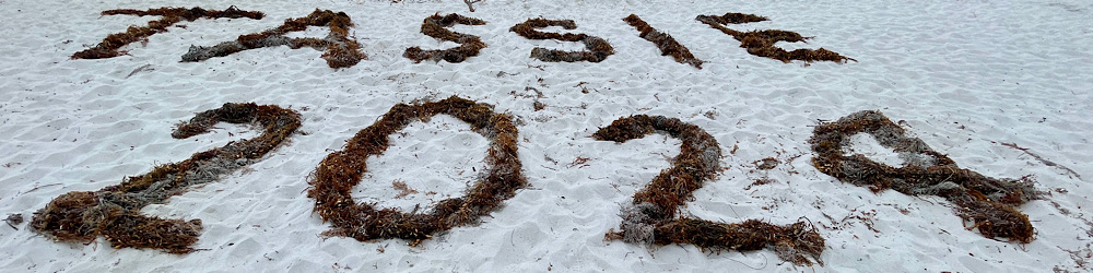
That effectively ends our time on the Gibb River Road. This route was 1250 kms, and now we’ve done about 6000 kms since we left home. We enjoyed the mix of seeing old favorites and exploring new places. Good to see that places were busy – harder for us as tourists needing to plan and book in advance but great for the businesses that have done it tough due to Covid.
Although we passed quickly through the NT, we were pleasantly surprised by the great places we found to explore. This map shows that section of our trip; largely places and roads we had not visited before.
Our first stop was a repeat visit to Banka Banka station -a well-run station camp with the nightly campfire and damper cooked by the hosts, a nice sunset lookout and some walks. A good place to catchup with showers and laundry, clean the van, bake cookies and just have a rest after all that driving. Temperatures starting to warm up so we could ditch the doona.
The view of Banka Banka station from the lookout at sunset. Shows how a working station has included a camping facility. Belle can be seen in the top photo if you look hard. We had a nice spot for our camp.
Shortcuts don’t always work out, but we found one that did when we left the paved Sturt Highway and ventured onto the unsealed Buchanan Highway. Not a popular road as we saw 5 vehicles in a 2 hr drive, including a tow truck with an SUV on it,
Airing down the tires for this unsealed road, that is called a highway! Fortunately the road was not too bad. We found a free camp in a river bed – no one else around.At this free camp we saw a dingo slink by and we heard a donkey braying. So far we haven’t seen many animals on the trip.This is Top Springs (its only a roadhouse). Dick said my picture made it look better than it was. We had an odd encounter there as we were airing up the tires. A young Taiwanese guy came up and asked if he could have our spare tire as he had blown one of his tires about an hour’s walk away. He had been on one of the worst roads in Aus and was totally unprepared (no hat, not much money or water or English). Somehow his story didn’t ring true, but we’ll never know…….Arrived at Victoria River Roadhouse and settled into the camping area. Decided we were far enough away from people that we could play our ukuleles. Just got started and a lady (Wendy) came over. She said it was karma as she also played and was camped next to us. So we invited her over and played together for a couple of hours. It was fun and we learned some new things from Wendy, who has been very helpful in sending us music etc.This map is from ‘Destination Top End’ by Birgit Bradtke. Best ever guide books. We use this one and ‘Destination Kimberley’ as our bibles for these trips. We liked this map as it shows the roads and campgrounds in this area. Our interest was in exploring the two national parks, although most of Gregory national park is only accessible for diehard 4-wheel drivers.
We had heard good things about Keep River and Gregory National Parks so were keen to visit them and were not disappointed. In fact these areas resemble much of the fabulous views in the Kimberley with the red cliffs, escarpments and palms.
Our first walk was Joe’s Creek Loop Walk and it was a bit of a shock to the system as it was harder than expected, but we were rewarded with magnificent escarpment views, Livistonia palms and rock art.We met Neil and Suzanne on this walk and Neil was very good at spotting the ancient aboriginal rock art. They are a bit younger and fitter than us, and slowed down to keep an eye on us to make sure we made it through ok on the rough track.Livistonia Palms line the steep rocky slopes to the base of the escarpment wall which we followed along on this 2 km walk which took us 2 hours – lots of photos but also rest stops as it was not easy walking on all the scree and rocks.The views of the escarpment and the valley were really something.We stopped to look at the old Victoria River crossing and ended up walking the last km as it was too rough for Belle. Not much to see there except be glad we didn’t need to use that crossing these days. The view of the river from the Victoria Roadhouse where we camped, gave a better appreciation of the river.Checked into the Timber Creek Hotel Caravan Park (CP) and found the nicest amenities since we left Middle Cove. Plus they had good internet, a nice restaurant, ok pool and ‘Crocodile and Kite Feeding’ at 5 pm. Whats not to like! The freshwater crocs shown above looked very aggressive compared to their usual reputation.
After we checked out of the Timber Creek Hotel CP, we drove to the town lookout and learned some really interesting WW II history.
This town lookout is called the Nackeroo Lookout and it tells the story of the North Australian Observation Unit (21st NAOU) affectionately known as the ‘NACKEROOS’. The concept for the group of ‘bush commandos’ to watch over northern Australia following the Japanese bombing of the Top End and the NW of Australia, was introduced by Major Stanner, an anthropologist. Their task was to patrol the northern coastal areas(usually on horseback) for signs of enemy activity, man coastwatch stations and run a signals network. At its peak the unit consisted of 550 men and employed 59 aboriginal people.This is one of the plaques which sums up what the troops had to deal with. Its a clever poem. Too bad the author is not known. All of this information comes from a book, Curtin’s Cowboys Australia’s Secret Bush Commandos, as noted in the photo above.
Other plaques indicated that the war with the Japanese was overshadowed by the battle with the harsh environment, including the daily search for fresh water. With their bush skills and efficient use of the environment, the aboriginal guides were invaluable in helping the Nackeroos to survive. Without their dedication and knowledge, this functional reconnaissance unit could not have operated.
This is the view of Timber Creek from the town lookout, which is close to the Nackeroo Lookout and shares similar vistas. Victoria River is the largest waterway in the NT, arising south of Wave Hill in the desert and flowing 800 kms to the Timor Sea. Not sure why they built or promote this Bradshaw walking bridge over the Victoria River, but it could have something to do with this sign that greets you at the end of the walking bridge.This small national park sits very close to the NT/WA border and is a real gem featuring aboriginal sites, spectacular geology and some great walks. We think it is one of the nicest parks we have visited.Cockatoo Lagoon is a great bird watching spot and made a nice picture in the noonday sun.Two beautiful campgrounds and our two campsites in Keep River NP.We did some great walks in Keep River NP. The first walk was a 2km walk from our campground and featured lots of escarpment and bee-hive shaped “bungle-like” sandstone rock formations.Unusually for us we started walking about 8am to avoid the heat and get the benefit of the early morning light.The views were fantastic – so much variety in such a short walk.Happy faces as we finished the pre-breakfast walk, feeling that was a good way to start the day.The desert wildflowers were pretty nice too! We saw most of these when we did an afternoon walk along the Keep River bed.The 7 km loop walk from the upper campground just opened for the season the last day we were there, so we got up before sunrise and were walking by 7:30am, probably the first ones on the trail. You can see the moon is still around in this photo.The scenery on this walk was quite different and it was a pleasant walk; ie not too difficult.We caught up with more new friends on this walk (stranded Victorians who couldn’t cross the border) so we gave them our leftover fruit and veg that we could not take into WA due to quarantine laws.The end of this walk marked the end of our time in the NT. We drove the 25 kms from Keep River to the WA border and managed to cross without issue as we had our G2G (Good to Go) passes (strictly enforced state border controls due to Covid) and our empty fridge passed the inspection by the quarantine officer.