Since the route home was unplanned, the last part of our trip through Queensland and NSW was about finding new places to explore in territory we had passed through a few times, and we managed to find some….
This is the map of our trip home from Boulia (3900 kms over 22 days).The caravan park in Boulia, (population 300 and Land of the Min Min Lights) was good for a three day rest and it came complete with camels, a pony, chickens, goats and brolgas. The pony was keen to check out Belle.
Aside from doing laundry and emails, joining in for happy hour and eating in the pub one night, the one Boulia attraction we visited was ‘The Min Min Encounter’, which is a 45 minute laser and animatronic show. It was an impressive show and display telling the story of the Min Min Lights, unexplained balls of glowing light that appear to travellers at night in this area. The show features stories of people’s experiences where the strange light follows them home or just appears around them. It was a bit spooky and scary for some of the people who spoke in the videos. The woman who did our tour was a local and she was very authentic, so I asked her if she had ever seen the Min Min Lights – she said she had driving home late one night, they followed her home.
Just out of Boulia on the road to Bedourie, we stopped to check out a small grove of protected Waddi Trees. There are only three stands left in Australia. We did see another stand in the Northern Territory a few years ago. Some of these trees are almost 1000 years old and the timber is almost impossible to burn.This is the view from the Vaughn Johnson Lookout, which is the highest point on the cusp of Diamantina Shire and overlooks the Queensland Channel Country. We drove through a lot of very flat land, lots of floodway signs and no towns.We were attracted to the Bedourie Aquatic Centre and Thermal Spa, so we stayed two nights in this town of 100 people. In 1905 the artesian bore was sunk to 1213 feet and in 1970 their electricity was connected. I liked the Dust Storm sculpture and the Aquatic Centre with its 25 m pool was nice at 30 C, unlike the thermal spa at 41 C. As a bonus, they had good internet!On the drive to Windorah we came across an airstrip on the road.Found a lovely free camp at Cooper Creek, near Windorah. Quiet, pleasant view and INTERNET! Good for a 3 day rest stop.Our second visit to Quilpie (population 600) was much better than the first. These are the two different campsites we had staying at The Lake Quilpie. We moved from the lakeside to be closer to the amenities, the laundry and the happy hour!HAPPY HOUR at Lake Qulpie. This one had a fire and a bar. Good place to meet people and compare travel notes.Dramatic sky at the end of a day in Quilpie. We had a nice day exploring the town, unlike the previous visit on a Sunday when everything was closed. Visited galleries, a museum, did all the normal stockup chores, had lunch in a cafe and even managed some retail therapy (new outback shirt for me).Sunset drinks at the top of Baldy Lookout with Paul and Jenny who we met at Happy Hour the night before.Eromanga (population 120) is another special dinosaur stop. Their Natural History Museum, now in a fabulous new building that only opened four months ago, houses bones from the largest land dwelling animals – ever. Cooper, named after Cooper Creek and Cooper Basin, is Australia’s largest dinosaur and in the top 10 in the world. Based on the remains that have been found, it is believed he would have been 30 meters (100 ft) long and 6.5 meters (21 ft) high (from ground to hip). Above are reconstructions of the leg bones and the large space is where museum staff and volunteers work on the bones that have been dug up and wrapped until there are people available to work on them. The museum offers Dinosaur Dig experiences and depends on the work of volunteers who work with the palaeontologists and geologists in the field and in the museum. We enjoyed the tour and learning about these discoveries. They also offer Megafauna dig experiences since the megafauna bones found at Eulo are also worked on in the museum.Here is a picture of what Cooper, the largest dinosaur, would have looked like 95 million years ago. The second picture is a life-size art sculpture of a Sauropod and her two babies, which was commissioned for the G20 Summit in Brisbane and donated to the Eromanga Natural History Museum.Leaving Eromanga late afternoon we found an amazing free camp and caught another ‘red rock’ sunset.Its only for a couple of minutes, but those end of day colors are stunning. Here we have our own light show and no one else for miles around.
For those unfamiliar with the history, Burke and Wills were the first explorers to cross Australia from south to north in 1860-61. The expedition was fraught with disaster and both Burke and Wills died after achieving their goal, primarily because their supply team at the depot left the depot just hours before Burke and Wills returned from the coast. The Dig Tree is located at that depot, and is the place where supplies were buried so the local aboriginals would not find the supplies. The supply team wrote ‘DIG’ on the tree to alert Burke and Wills that they needed to dig to find the extra supplies left for them. Controversy surrounded that expedition and there are still conflicting reports being debated today.
During this trip we listened to the audiobook, Burke & Wills by Peter Fitzsimmons, so it felt appropriate to visit the famous Dig Tree. Here is the entrance with lots of signage explaining the history of the Burke & Wills Dig Tree. The station owners provide free camping along Cooper Creek at the Dig Tree, so we found a nice camp for the night.There are three significant coolabah trees here that Dick is standing in front of. The original dig tree, where the supplies were left for Burke and Wills in 1860. It had a blaze and the word ‘DIG’ carved into it. Then in 1862 a member of the second Howitt expedition to Cooper Creek carved DIG in another tree. In 1898 photographers, John and Minnie Dick, decided to carve a memorial to Burke on the Dig Tree. The owner of the land at Cooper Creek ‘suggested’ they do the carving on another tree 30 meters away; hence the face tree, as you can see above.After a night in a Thargomindah (population 300) caravan park, we decided to do a free camp at Lake Bindegolly NP. The string of salt and freshwater lakes are rain-fed via local catchment areas, and form an important wildlife refuge in this arid zone. It would be quite different in wetter times,This was our 11 km walk at Lake Bindegolly – easy walking, quite boring and no shade. We did see 12 brolgas, a few ducks and birds and one feral pig. Because it was so dry, the lakes were quite shallow and not much bird life around.However, we saw some flowers along the walk.
Next stop was Cunnamulla (population 1140) and as creatures of habit we returned to our old campsite in the caravan park. There we finally decided to return home so we crossed the border and returned to Moree. This time we tried a new caravan park which boasted 6 thermal pools. It was pleasant and would be a good stop if you wanted to lounge about in thermal pools with temps ranging from 36-41 degrees C.
Lots of driving and as this photos shows, some emus can’t resist running in front of cars. That lovely little blue bird was a regular visitor to our camp at Red Rock.After all that time in desert and all those rocks, we decided to indulge with a couple of days on the beautiful NSW coast. Red Rock (just north of Coffs Harbour) is a favorite camp spot – good beach, nice walks, good campground and INTERNET,We enjoyed both beach and bush walks, and even saw this gnome tree in the bush. Sign reads ‘gnome sweet gnome’ so someone has gone to a bit of trouble creating this along one of the tracks. Red Rock was a nice way to finish up our trip, and our time there coincided with a NSW statewide lockdown – right time to be heading home.This is why we were keen to get home. We were home for two weeks before the boys, Seb and Jake, got out of hospital as they were born at 30 weeks. The new grandparents can hardly believe how special it is to be with them.These little guys are doing well and its a delight to be with them. Their parents, Helen and Anthony, are relishing their new roles; so Seb and Jake are in good hands.
Thats the end of this blog and the beginning of a very exciting chapter in our lives,
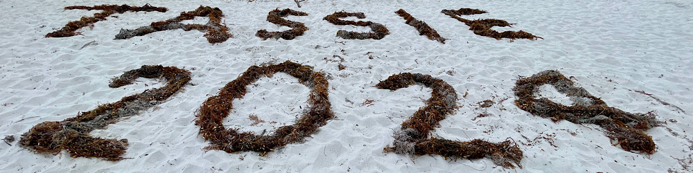
On our trip we travelled 16,500 kms over 99 days. This is how the final trip map worked out.For those of you interested in statistics, here is the latest summary.
This section of our trip gives us lots of time on iconic, outback, unsealed roads. In fact more than we’d originally bargained for, as it turns out.
The map of this section crosses three states and a distance of 2745 kms. It took us 10 days; excluding the backtrack of 2 days and 314 kms for the tire issue and including our 2 days in Alice.We thought we’d said ‘goodbye’ to Laverton and Leonora (small towns in WA) when we headed up the Great Central Road (GCR) on a cloudy, windy day.
The GCR is part of the Outback Way, Australia’s longest shortcut. The Outback Way provides the third strategic road link across the continent, linking Laverton WA to Winton, Queensland. It is 2700 kms, 1300 kms of unsealed road and 1400 kms of sealed road. This project opens up new tourist routes, new transport routes (it reduces the east west connection by 1600kms), better access for mining and pastoral interests and improved access for remote indigenous communities. So its been on Dick’s wish list for a while.
After two hours we pulled over to air down (reduce the tire pressure to make it more comfortable and better for the tires on rough roads) and found a rear flat tire and it was sprinkling with rain. This was a bad hole and not repairable by Dick, so 2.5 hours after we stopped we turned around and headed back towards Leonora.We needed to stop at a free camp on the way back and then ended up back in the caravan park in Leonora for one night. This is what happens when you get the last spot in a caravan park – between two long term residents! Made me glad we don’t have to live in a caravan park in remote WA. That said we had no trouble there.
We got the tire repaired (it was a large hole) and we bought a second spare which now lives in the shower, so two days later we again started on the GCR. Sometimes things have a way of working out. As it turns out Helen and Anthony’s twins were born the day we first started the GCR, so the fact that we were back in town for two nights meant we could have more time speaking with Helen on the phone and seeing photos of the twins.
Different views along the GCR. In reality it was not a bad road, some variation in the landscape and just a lot of driving; 1126 kms (700 miles) to Uluru..Counting our first night going back to Leonora, we had four free camps along the GCR. We could have stayed at some roadhouse caravan parks, but preferred these locations instead – no barbed wire around security fences! The Warburton Roadhouse caravan park featured this sign: “For your peace of mind: We lock the front gate about 7pm thru to 7am. Warburton is no different to any other place on this planet. Sometimes bad things happen.”In the three days along the GCR, we saw way more wrecked cars than anything else.On the second day we saw 3 cars, 2 road graders and about 15 camels. This is a gif of camels running along the road. Apart from the camels on the GCR, we saw one dingo and one majestic black horse.
The one stop I wanted to do on the GCR was to visit the Tjulyuru Exhibition Space and Gallery at Warburton. It is an impressive building and showcases the most substantial collection of Aboriginal art in the country under the direct ownership and control of Aboriginal people. There were lots of huge, attractive paintings in the gallery as well as glass works and weavings. The shop also had a good array of paintings, glassworks and other items to purchase. AND – we were the only ones there. They opened the gallery for us. I suspect lack of promotion and signage contributes to the lack of interest from passers by. No photos to show as it was forbidden to take photos anywhere in Warburton. However in the shop they did let me facetime with Amy so I could show her some paintings I had thought she might like for her birthday. She picked one. Unusual but quite a good way to shop in a gallery.
The final stop we did on the GCR was to visit Lasseter’s Cave and learn the story of his search for gold and his demise, as outlined in this sign..Not a very big cave and not an auspiscious monument.The first sight we saw as we crossed into the Northern Territory (NT) was Kata Tjuta (formerly known as The Olgas). No one and no signs at the border, but we were ready with all our passes. Kata Tjuta is a group of 36 large domed rock formations spread over more than 20 kilometers. It remains deeply spiritual and sacred to the local Anangu people who have lived here for more than 22,000 years.The top rock is Uluru (16 kms driving around the base) and the bottom rock is Mt Augustus (49 kms driving around the base). Mt Augustus is twice the size of Uluru and advertised as the largest rock in the world. We visited it recently so I was keen to see how the two of them compared. After we passed Kata Tjuta we saw Uluru from the distance as we headed straight for the campground at Yulara (formerly known as Ayers Rock Resort), the only place we could camp in that area.The Valley of the Winds walk at Kata Tjuta was the one walk we had not done five years ago, so our plan was to do this walk. We were looking forward to doing it, and we were not disappointed.It was a warm/hot, beautiful sunny day for our walk. We did the full circuit and hoped we could manage the grade 4 walk.The rocks were stunning during the early afternoon light. Didn’t see them at sunset but they are supposed to be amazing then.It wasn’t an easy walk in the heat but certainly worth doing.Smiles as we were both pleased that we managed to do the walk without incident. We did 9kms in about 4 hours.To complete our brief Uluru experience, we drove out for the sunset viewing. Previously we had done the walk around Uluru. This time we firstly we drove around Uluru and then we drove to the classic sunset viewing spot.Just before sunset the colors are amazing. Lots of people out having a look, even though the village is much quieter and suffering from lack of overseas visitors
As per our plan Yulara was a good three day stop for supplies, laundry, a couple of meals out, a good walk and a sunset viewing of Uluru. All was going well, until just before we drove out of Yulara heading for South Australia, we heard that all of South Australia was in a 7 day lockdown. During the 246 km drive to the Sturt Highway, we debated our options – and decided in the end that we did not want to do a 7 day lockdown on the SA border. So we turned north at the Sturt Highway (instead of south) and headed for Alice Springs and a Queensland route home.
On the way to Alice Springs we camped at Rainbow Valley, an old favorite camp spot. Just arrived in time for me to get one sunset photo. The light in Central Australia really works magic on the rock formations. Such a difference in this place during the day and at sunset.Getting into Alice felt a bit like coming home – checked back into the Big 4 caravan park (where we spent many weeks in 2018), got to shop for groceries in my favorite supermarket (Woolworths), and got our second Covid shots, Dick got a blood test, and we went out for dinner with Geoff and Vicki, friends who had just arrived in Alice that day. We only had two nights there as we were on a mission to get closer to NSW. Not our most scenic camp spot but we did have our own toilet and shower!Dick has wanted to do The Plenty Highway for ages. So in spite of my misgivings about the road we decided to save 500 kms and give it a go. It was busier than the Great Central Highway and was a better road, with lots of sealed road along the 745 kms to Boulia, Queensland.After finishing all the jobs for travel, we left Alice before 10am and got to our stop at Jervois Station before 3pm. Had a nice camp near a dry riverbed and had time for a uke practice.VIEWS OF THE PLENTY HIGHWAY – notice any similarities?? Actually the road was not too bad.Most people talk about the perils of the bull dust (see above) on the Plenty Hwy, but Belle just ploughed on through it like it wasn’t there. We think the low tire pressure helped and also the hard work of the road crews. Throughout this trip we’ve seen a lot of roadwork being done on most of the unsealed roads.Again we did not see many animals on this road; some cattle and many eagles. The eagles were generally eating roadkill on the road. Interesting that through this whole trip we have not seen many dead animals by the side of the road. In the past we have seen lots of dead and alive kangaroos. Perhaps numbers are down because of the drought??Contemplating a long driving day, we got fuel and left camp just after 9am. Fortunately it was an uneventful day – road had some corrugations and bull dust but was not as bad as expected. As we passed the next regular camping spot, Tobermory Station at around 1pm, we decided to push on. Got into a caravan park in Boulia just before dark at 6pm, which finished our time on the Plenty Highway..
Given the uncertain Covid situation, we know we are travelling through Queensland to get home but the route is not yet decided and will probably change a few times as we work out our timing for a return to Sydney.