On the way to WA – the NT (Northern Territory) bonus

Although we passed quickly through the NT, we were pleasantly surprised by the great places we found to explore. This map shows that section of our trip; largely places and roads we had not visited before.

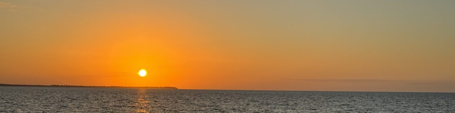
Our first stop was a repeat visit to Banka Banka station -a well-run station camp with the nightly campfire and damper cooked by the hosts, a nice sunset lookout and some walks. A good place to catchup with showers and laundry, clean the van, bake cookies and just have a rest after all that driving. Temperatures starting to warm up so we could ditch the doona.

The view of Banka Banka station from the lookout at sunset. Shows how a working station has included a camping facility. Belle can be seen in the top photo if you look hard. We had a nice spot for our camp.

Shortcuts don’t always work out, but we found one that did when we left the paved Sturt Highway and ventured onto the unsealed Buchanan Highway. Not a popular road as we saw 5 vehicles in a 2 hr drive, including a tow truck with an SUV on it,

Airing down the tires for this unsealed road, that is called a highway! Fortunately the road was not too bad. We found a free camp in a river bed – no one else around.
At this free camp we saw a dingo slink by and we heard a donkey braying. So far we haven’t seen many animals on the trip.
This is Top Springs (its only a roadhouse). Dick said my picture made it look better than it was. We had an odd encounter there as we were airing up the tires. A young Taiwanese guy came up and asked if he could have our spare tire as he had blown one of his tires about an hour’s walk away. He had been on one of the worst roads in Aus and was totally unprepared (no hat, not much money or water or English). Somehow his story didn’t ring true, but we’ll never know…….
Arrived at Victoria River Roadhouse and settled into the camping area. Decided we were far enough away from people that we could play our ukuleles. Just got started and a lady (Wendy) came over. She said it was karma as she also played and was camped next to us. So we invited her over and played together for a couple of hours. It was fun and we learned some new things from Wendy, who has been very helpful in sending us music etc.
This map is from ‘Destination Top End’ by Birgit Bradtke. Best ever guide books. We use this one and ‘Destination Kimberley’ as our bibles for these trips. We liked this map as it shows the roads and campgrounds in this area. Our interest was in exploring the two national parks, although most of Gregory national park is only accessible for diehard 4-wheel drivers.

We had heard good things about Keep River and Gregory National Parks so were keen to visit them and were not disappointed. In fact these areas resemble much of the fabulous views in the Kimberley with the red cliffs, escarpments and palms.

Our first walk was Joe’s Creek Loop Walk and it was a bit of a shock to the system as it was harder than expected, but we were rewarded with magnificent escarpment views, Livistonia palms and rock art.
We met Neil and Suzanne on this walk and Neil was very good at spotting the ancient aboriginal rock art. They are a bit younger and fitter than us, and slowed down to keep an eye on us to make sure we made it through ok on the rough track.
Livistonia Palms line the steep rocky slopes to the base of the escarpment wall which we followed along on this 2 km walk which took us 2 hours – lots of photos but also rest stops as it was not easy walking on all the scree and rocks.
The views of the escarpment and the valley were really something.
We stopped to look at the old Victoria River crossing and ended up walking the last km as it was too rough for Belle. Not much to see there except be glad we didn’t need to use that crossing these days. The view of the river from the Victoria Roadhouse where we camped, gave a better appreciation of the river.
Checked into the Timber Creek Hotel Caravan Park (CP) and found the nicest amenities since we left Middle Cove. Plus they had good internet, a nice restaurant, ok pool and ‘Crocodile and Kite Feeding’ at 5 pm. Whats not to like! The freshwater crocs shown above looked very aggressive compared to their usual reputation.

After we checked out of the Timber Creek Hotel CP, we drove to the town lookout and learned some really interesting WW II history.

This town lookout is called the Nackeroo Lookout and it tells the story of the North Australian Observation Unit (21st NAOU) affectionately known as the ‘NACKEROOS’. The concept for the group of ‘bush commandos’ to watch over northern Australia following the Japanese bombing of the Top End and the NW of Australia, was introduced by Major Stanner, an anthropologist. Their task was to patrol the northern coastal areas(usually on horseback) for signs of enemy activity, man coastwatch stations and run a signals network. At its peak the unit consisted of 550 men and employed 59 aboriginal people.
This is one of the plaques which sums up what the troops had to deal with. Its a clever poem. Too bad the author is not known. All of this information comes from a book, Curtin’s Cowboys Australia’s Secret Bush Commandos, as noted in the photo above.

Other plaques indicated that the war with the Japanese was overshadowed by the battle with the harsh environment, including the daily search for fresh water. With their bush skills and efficient use of the environment, the aboriginal guides were invaluable in helping the Nackeroos to survive. Without their dedication and knowledge, this functional reconnaissance unit could not have operated.

This is the view of Timber Creek from the town lookout, which is close to the Nackeroo Lookout and shares similar vistas.

Victoria River is the largest waterway in the NT, arising south of Wave Hill in the desert and flowing 800 kms to the Timor Sea. Not sure why they built or promote this Bradshaw walking bridge over the Victoria River, but it could have something to do with this sign that greets you at the end of the walking bridge.
This small national park sits very close to the NT/WA border and is a real gem featuring aboriginal sites, spectacular geology and some great walks. We think it is one of the nicest parks we have visited.
Cockatoo Lagoon is a great bird watching spot and made a nice picture in the noonday sun.
Two beautiful campgrounds and our two campsites in Keep River NP.
We did some great walks in Keep River NP. The first walk was a 2km walk from our campground and featured lots of escarpment and bee-hive shaped “bungle-like” sandstone rock formations.
Unusually for us we started walking about 8am to avoid the heat and get the benefit of the early morning light.
The views were fantastic – so much variety in such a short walk.
Happy faces as we finished the pre-breakfast walk, feeling that was a good way to start the day.
The desert wildflowers were pretty nice too! We saw most of these when we did an afternoon walk along the Keep River bed.
The 7 km loop walk from the upper campground just opened for the season the last day we were there, so we got up before sunrise and were walking by 7:30am, probably the first ones on the trail. You can see the moon is still around in this photo.
The scenery on this walk was quite different and it was a pleasant walk; ie not too difficult.
We caught up with more new friends on this walk (stranded Victorians who couldn’t cross the border) so we gave them our leftover fruit and veg that we could not take into WA due to quarantine laws.
The end of this walk marked the end of our time in the NT. We drove the 25 kms from Keep River to the WA border and managed to cross without issue as we had our G2G (Good to Go) passes (strictly enforced state border controls due to Covid) and our empty fridge passed the inspection by the quarantine officer.

Off to WA (West Australia) via NSW & Queensland

The plan for this trip is to revisit some favorite places in the Kimberley and see lots of new places, including a drive along the Great Central Road from Laverton,WA to Uluru, in the Red Centre, NT.

Here is the map of our proposed route (taken from the Wiki Camps planner). The red line shows where we’ve been and the green line is the plan for the rest of the trip.

In order to focus on what we really want to see in WA, we decided to travel quickly through NSW, Queensland and parts of the Northern Territory (NT). Then Dick found a music festival in Queensland that sort of fitted with our itinerary, so we included it.

We’ve had some really nice camping spots in the first two weeks, and we’ve enjoyed hot pools, spa baths and bathtubs. There’s always something interesting to find when you look for it.

Moree is known for thermal springs so in an ordinary caravan park there, we scored a campsite by the river and a soak in the 41C thermal pool. We also used the last of our NSW free dinner vouchers so we could leave NSW with a clear conscience. The NSW government gave each citizen 2x$25 restaurant vouchers and 2x$25 entertainment vouchers to stimulate business in the state. We did our bit on the eating!
These painted silos at Thallon encourage people to stop or camp there.
Here I am with the Northern Hairy-Nosed Wombat, Queensland’s most endangered mammal. In the 1970’s only about 35 remained, so a conservation program was started and now there are more than 200 in two colonies.

So between visiting the silos and William the Wombat, we covered the sights of Thallon; and then found a lovely free camp along the Moonie River.

No one else around so we could play our ukuleles, and we did a walk along this beautiful river which is available for free camping.
Enjoyed our first campfire for the trip and used Dick’s handy device (chunk of wood with a slot in it) to get our photo.

Dick did his balance class on Zoom before we left the free camp and headed for Charlotte Plains Station (sheep or cattle farm) with its hot bore and bath tubs. The owner told us the property has been in her family for 98 years. Dick told her she didn’t look that old!

The bore water comes from the Great Artesian Basin, one of the largest underground reservoirs on earth. It is 100-250 million years old and takes up one-fifth of Australia. The oldest groundwater has been dated to near 2 million years old. The depths of the aquifer systems range from 100m-3000m and the water is predominantly fresh and safe for human and animal consumption.
So of course, we had a bath! We also had a nice, quiet night in a pleasant setting. Good to see stations coming up with ways to attract paying customers.

Scored a pleasant riverside camp in a good caravan park in Cunnamulla, explored the town, Dick bought appropriate outback style boots and we took the mandatory photo with the ‘Cunnamulla Fella’ made famous in a Slim Dusty song of the same name.

The town of Cunnamulla has erected a statute of ‘The Cunnamulla Fella’ as a tribute to the writer of the song (Stan Coster) and the singer (Slim Dusty). The statute is double life size bronze.
Fossils of the Diprotodon, the largest known marsupials to have ever lived, have been found in the Eulo area and are on display in the Eromanga Natural History Museum. This life size statute is in Eulo. Diprotodons are giant wombat-like marsupials who lived in Australia between 1.6million and 45,000 years ago. Their name means “two forward teeth”. Another Queensland dinosaur area!

Continue reading “Off to WA (West Australia) via NSW & Queensland”