This post covers our Tasmanian travels from the 15th of March until we returned home on the 28th of March. For some reason its been a challenge finishing the posts for this trip. I guess we were too busy to write anything while we were on the trip.
Afterr leaving St Helens, we headed to Ben Lomond National Park (NP) just so we could drive up and down Jacobs Ladder. Of course there is more to see in the park, which is effectively a mountain island set in a sea of agricultural and forested lowlands. It is a 1500 m high plateau with distinctive alpine moorland plus vast screes and boulder fields of dolerite, which were created during recent ice ages. The park plays an invaluable role in regional flora and fauna conservation.
Jacobs Ladder is one of Australia’s most photographed roads. The zigzag mountain road is made up of six hairpin turns that head straight to the area’s alpine plateau.The alpine moorland is home to over 200 different plant species and an abundance of Bennett’s wallabies, wombats, pademelons, Forester kangaroos, eastern quolls, echidnas and platypus. We saw a few kangaroo-like animals but not sure which ones we saw. As we approached Jacobs Ladder, it doesn’t look like such an adventurous drive, but we had seen photos and videos from others so we knew what to expectAs we climbed the Ben Lomond Summit Track, we enjoyed great vistas of the alpine plateau.
From here we entered the Great Western Tiers, the name of a popular touring region and a collection of World Heritage listed mountain bluffs that form the northern edge of the Tasmanian Central Highlands plateau. The Tiers stretch northwest to southeast over 100 kilometres and are places of diverse beauty with spectacular natural features, history and heritage and amazing geological features. The region is in the Meander Valley and boasts a rich heritage, amazing arts and crafts, gourmet food, wilderness and adventure. We had no idea how varied and interesting this area would be as we could have used more time here. However we did manage to see a lot of the highlights.
Our first day in the Great Western Tiers turned out to be a mega day with heaps of variety; scenic drives, amazing silk artwork, extensive museum, lunch with Explorer friends, Marg and Paul, hiking at Liffey Falls, and seeing pencil pines at Pine Lake.
The picture says it all.First stop was Deloraine, which had a great Visitor Centre that housed an excellent museum and this amazing artwork, Yarns Artwork in Silk. This large scale textile project consists of four large quilted soft sculpture silk panels, one for each season, depicting the landscapes, culture, local characters and different stages of the Meander River. Very beautiful.
The history of the artwork is a good story about community and craft that started in the early 1990’s. If those areas don’t interest you, you might want to skip this paragraph. A retired farmer got inspired by a theatre curtain he saw in Griffith, NSW so he got a group together to work on a textile artwork project. Eventually over 300 volunteers were involved in the project. They cobbled together funding from various places and had community involvement in the designs, coordination and production of the artwork. Techniques were developed to enlarge the designs, dye the silk and incorporate various materials and embroidery styles to complete the four panels, which depict the flora and fauna and post-colonial settlement of the region. It is estimated that it took some 10,000 hours to complete, over 200 square metres of silk, plus tulle, wool, cotton, velvet, lace and enough thread to circle the world several times. Craft techniques used included crochet, applique, patchwork, quilting, spinning, weaving, beading, rouche, tufting, embroidery, silk painting and dyeing. Certainly worth visiting if you are ever in Deloraine.
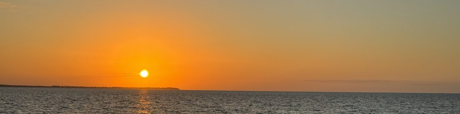
It was a one hr return hike through towering eucalypts, myrtles and massive tree ferns to Liffey Falls. A pleasant walk and nice falls,Our next stop was Pine Lake where we got to see one of Tasmania’s rarest trees, the pencil pine (Athrotaxis cupressoides). They are the dominant trees at Pine Lake and one of the most frost-resistant trees in Australia. You will notice that the leaves are reduced to small scales which wrap tightly around the branchlets. This reduces heat and moisture loss, which enables pencil pines to survive in a climate which would kill most other trees. It probably helped them survive during the last ice age. The altitude here is 1200 meters so we were lucky to be there in summer.I thought this sign gave an interesting perspective on the history of these pencil pines which are found only in Tasmania but they belong to the same family as the tallest tree in the world, the giant California Sequia. They have their origins on the southern continent of Gondwana and are among the great survivors of aeons of ravaging change. They can reach ages in excess of 1200 years.An easy walk on the boardwalk took us through the alpine landscape of small mountain lakes, pencil pines, cushion plants and pineapple grass to Pine Lake. Despite their ancient origins and having survived several ice ages Pencil Pines are now in a very vulnerable position. They are extremely fire-sensitive and large numbers have been killed by past burning practices and escaped campfires. They are, therefore, vulnerable even in protected areas such as national parks, and their white ‘skeletons’ are an eerie reminder for us to take care with fire. It felt like a special place to visit and we were the only ones there at the end of the day.Our free camp at the end of day was just a pull off at the side of the road with an impressive view and lovely sunset. One of the benefits of being self contained.The first stop on the 17th of March was the Alum Cliffs/Tulampanga (a sacred celebration place which means ‘red ochre hill’). This country was very spiritual and sacred to the Pallittorree Peoples. The ochre from this place was held in high regard and was traded with other tribes. Only the Pallittorree women were allowed to dig or gather the ochre from the hillside – men were not allowed in this domain. After the women had gathered their ochre, they would proceed down to the open plains and corroboree grounds (now Den Plains) where a range of busy activity would take place. Women, men and children would paint themselves, creating ochred hairstyles and painted body designs to dance into the night. The limestone from which these caves have developed was formed about 450 million years ago. At that time, Tasmania was part of the supercontinent Gondwana and lay close to the Equator.KING SOLOMONS CAVE – where we did a one hour tour and enjoyed the views and the story of the cave. The cave is regarded as a relatively ‘dry’ cave as it has no stream flowing through it. A stream has previously flowed through the cave but this has long since cut deeper into the limestone and abandoned King Solomons Cave. While the stream was important in the corrosion of the limestone and the formation of the cave, its abandonment of King Solomons has meant the development of a stable environment that has allowed spectacular stalagmites and other formations to form. King Solomons Cave is part of an extensive “karst’* landscape, which contains over 200 caves, in the Mole Creek area.At the end of the day we tackled the 40 minute return hike to the stunning Devils Gullet Lookout. Again we had the place to ourselves.From the lookout we could see Cradle Mtn and Mt Ossa, the highest peak in Tasmania. We had end of day sun which has good and bad points. The Central Plateau we can see was formed over 200 million years ago and it has been glaciated (covered by ice) at least 5 or 6 times over the last 2 million years. The last ice age reached its peak on the plateau about 20,000 years ago. Not surprisingly over 4000 lakes lie on the surface of the plateau.We got a bit dizzy looking down from that cantilevered platform amd I still get that feeling from the photo. Its about 220 metres high.For a change we stayed in the Mole Creek caravan park, and we’re glad we did. In the morning we saw this platypus swimming in the creek next to our campsite. Always great to see platypus in the wild.
Our next stop was Sheffield, the town of murals, where we spent an interesting few hours. We visited the Visitor Info Centre, a large gallery and we walked all around the town viewing the murals.
In 1986 a group of locals decided to make their town become an outdoor art gallery to save the town from economic hardship. That worked well! With over 100 pieces of outdoor artwork on display on the town buildings, Sheffield is now known around the world as ‘The Town of Murals’.This mural really impressed me as it is a moving tribute to the local GP who served the municipality for 30 years (1946-1976). Underneath the picture is a description of the role he served in his community as follows:. “A huge practice for one man and he did the lot! For over thirty years ‘Doc’ Sender was on call 24 hours a day, 7 days a week, 365 days a year, many specialists rolled into one, even a vet on occasion, at times dental assistant to his wife, June. Dedicated, skilled, determined and without fuss. No medical challenge was too much for him to tackle. No nurse! No Secretary! No appointments! 2 sessions a day at the Sheffield surgery. Once a week at Railton, once a fortnight at Wilmot. One weekly surgical session– Latrobe Hospital. Daily house calls after hours all over the district. Accidents and emergencies all over the district.” It was kind of special to see that GP acknowledged so publicly.After being so impressed with Sheffield, we were very disappointed with Railton, Town of Topiary. That name is misleading and should be called false advertising as we only saw 3 or 4 topiary characters in good shape and we could hardly find any. We must have missed the heyday.
Our home for the next three nights was Narawntapu NP. It used to be known as Asbestos Range NP, so no wonder they changed the name. Actually it was the first NP in Tasmania to revert to an aboriginal name. We camped in Koybaa, one of four campsites there and just 100 m from the beach. We finished our day with a sunset walk along the beach.
We decided to do the main walk in the park, up to Archers Knob. It was a great hike via a well-constructed zig-zag track, up 114 m high to the top. There were lots of pademelons, bennetts wallabies and forester kangaroos and it was almost like we saw something around every corner.Panoramic views of Bakers Beach, the Springlawn lagoon (paperbark swamp) and Port Sorrel estuary greeted us at the top of Archers Knob.We did do the last 2.5k’s in the rain; so out of 8 k’s that wasn’t so bad. We had rain coats and managed ok. Here we could see the rain and storm coming at us from both directions.We scored some nice sunset colors after that rain in the afternoon.After a lazy day we had a final beach walk on a windy and beautiful Bakers Beach, before having final drinks with Steve and Denise who joined us for one last camp.This is our view of Devenport harbour from the ferry as we leave Tasmania on the 22nd of March. It was an early start for us to get the 8:30am ferry, but we made it and had a relaxing and calm daytime crossing in our booked recliner seats in a very quiet room.
Some final impressions of Tasmania – herds of cows, very windy roads (mostly driven by Dick which I appreciated), beautiful sunny days, stunning beaches, farmlands, forests, dramatic mountains, great walks and waterfalls.
BACK ON THE MAINLAND – we had a very social time in Melbourne, visiting Stephanie and Ron for a couple of days, enjoying a delicious lunch at Elizabeth’s with her and Sal, and catching up with Margaret over coffee.
In Melbourne we had a nice visit with Stephanie and Ron, and slept in Belle on the street and used the pool and spa room in their building as our ensuite. It worked well!
Our first stop out of Melbourne was Golden Beach (C-9) which is on 90 mile beach, part of the East Gippsland coastline and an area we had not visited before.
The Trinculo was an iron sailing barque which was driven ashore in 1879. This 90 mile beach has always been challenging for sailors as the long sweeping expanse of beach means there is no where to escape when an onshore gale is blowing. We finished our day with a nice walk along this beautiful beach.After a stop in Sale we drove to Cann River and camped in a free camp along the river. The area used to be a caravan park and is now run by the Council as a free camp, probably to help the small number of businesses in the town. We didn’t contribute to the town as we ate in Belle.We were having such a nice time we decided to have one last stop on the drive home. After having lunch at the Bega Cheese Factory, we stayed at Pretty Beach, in a great National Park campground. We had time to do a 3 km walk and explore along the beach.This is a classic NSW south coast scene, kangaroos by the beach.
On the 28th of March we arrived home, 45 days after we left home on the 13th of February. It was a good trip and I was surprised at how much there was to see in Tasmania, especially since we have had 4 trips there since 2010, and numerous other trips before then.
This map, courtesy of whereUbeen, Dick’s travel app, covers the route of this final Tasmanian blog post.This map covers our complete Tasmanian trip, from the 13/2/24 – 28/3/24. 5100 kms travelled over 45 days AND WE SAW HEAPS!!!!!Just for our interest, we check out our statistics on the kind of camps we stay at. Here are the results for this trip. Interesting to note that over 40% were free camps and even some of the National Parks were also free, plus our driveway/street camps were free. Without trying we had about 50% free camps and if we’d wanted to, it would not be too hard to increase that number of free camps.
This marks the end of our 2024 Tasmanian trip posting (and it only took me 6 months to get it out).
Well Pat and Dick,
You certainly had a wonderful time seeing so much of Tassie! And the south coast of NSW is pretty good too isn’t it?
I would love to ride my MTB up Jacobs Ladder or, even better, to ride down. Hahhah.
Normally I wouldn’t be interested in the silk artwork, as you’ve warned readers about, but I found it fascinating. What a fabulous thing to make, it’s beautiful.
Thank you for sharing your trip with us again and, as always, I look forward to reading about the next one.
L
F