Its been a while between blogs because we had such a good and very busy time in Tasmania; and because on returning home we seemed to also have lots on.
On arrival in Devonport on the ferry, we had to get setup for our Tassie travels, with fuel and a major grocery shop, as all our fruit and vegetables were either eaten or given away to comply with Tasmania’s strict biosecurity laws. Afterall this is an island state 250 kms south of the mainland. The initial plan was to head for Cradle Mountain and do the Dove Lake walk, but that was too ambitious so we camped at Lake Gardiner in a popular free camp where we got the second last spot. It was a popular spot for seeing platypus but as luck would have it, other people saw them just after we walked away.
Dick enjoying the view at Lake Gardiner – great free camp and platypus spotting area.
Given we had already done most of the well known multi-day walks previously, and given we are not as fit as we were then, we decided to focus on ‘The 60 Great Short Walks’ in Tasmania, which are outlined in a very useful brochure. It was a short drive from our camp to the Cradle Mountain Visitor Centre, where we had to take a shuttle bus to Dove Lake. The 6km Dove Lake Circuit is known as one of Tasmania’s premier walks. We scored a hot, sunny day for our walk which weaves through rainforest and provides stunning views of Cradle Mountain.
At the beginning of the walk – we were happy and rested. That’s Cradle Mountain in the background.This is the view looking back to where we started. Lots of places to get down to the water’s edge on this walk.Great views of Cradle Mountain from most of the walk.Dick having a rest. The walk has lots of boardwalk over the rough sections.It is a one way walk as it is so popular. Amazing views around every corner. It took us just over 2.5 hours and we were both tired at the end. Then we left the stunning Cradle Moutain area and headed for the coast.Our night in the Boat Harbour caravan park on the north coast of Tasmania was uneventful and the view was terrific.Meeting up with Steve and Denise to commence our travels down the west coast, in our twin Explorer Motorhomes.
After a coffee stop, a visit to the Smithton Information Centre where we did a cheese tasting, and a grocery stop; we ended up camping behind the Marrawah pub, where we had dinner. Sadly the scenic free camp on the beach was full!
The red line on this map outlines The Tarkine Drive, which is a scenic drive through the greatest expanse of cool temperate rainforest in Australia and the second largest in the world. It marks the beginning of an overload of beautiful sights to see over two days.Our first stop was at the West Point State Reserve, and was just a taste of the stunning coastline ahead.We made a short stop at the Lighthouse and then we ventured down a little road and found another beach to explore, and a small spit of land to climb on at Mawson Bay.After we drove through Arthur River, our next stop was a lookout called Edge of the World which offered more great views of the Tarkine coast. We then drove to Couta Rocks and spent some time exploring the landscape and taking in the views.
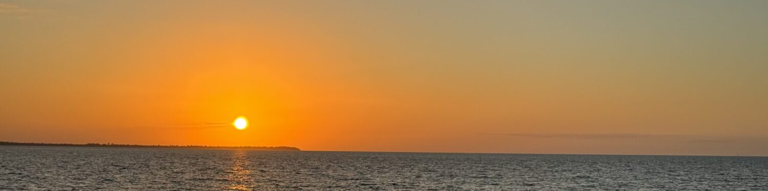
More exploring at Couta Rocks.We drove back up the coast to Nelson Bay and camped in a lovely free camp. That evening we did a 4 k return walk along the beach to see these petroglyphs, ancient aboriginal rock carvings, at Sundown Point. It was a very full day and to finish it off, I climbed a sand dune near camp and got a nice sunset photo. Hard to imagine we saw so many beautiful places in one day. This also finished the coastal section of the Tarkine Drive. Next comes the rainforest section.
The second day of our Tarkine Drive continued to be almost overwhelming as there was so much to see.
First stop of the day was the Sumac Lookout over Arthur River and the cool temperate rainforest.So many beehives around almost every corner of the Tarkine Drive.Rainforest walk through the man ferns at Julius River and a walk to Lake Chisholm, one of the finest examples of a flooded limestone sinkhole in Australia.This was a very scenic drive through the Tarkine with lots of stops.We thought it had been an amzing day already, but we were blown away by our last stop at the Trowutta Arch. A short walk took us to the huge arch leading to yet another large sinkhole. Naturally occuring and created by the collapse of a cave, resulting in the formation of two sinkholes – one dry and one wet on either side of the arch.
The water filled sinkhole is geomorphologically classified as a cenote (a steep walled water filled sinkhole) and is regarded as one of the best examples in Tasmania. It is more than 20m deep and is an important habitat for invertebrates. This was another great day where we saw so much, walked 6k’s and ended up at a free roadside camp at the Lindsay River on the Western Explorer Wilderness Drive, our next adventure drive.
Our first rainy day, as you can see in the photos, but we still saw lots of leatherwood plants and flowers, rivers and various lookouts.The Western Explorer Rd took us to Corinna, a historic mining town and bustling port in the 1800’s gold rush. It is now a restaurant, accommodation and staging point for the Fatman Barge. On the other side we continued inland along windy roads through a remote area with lots of dams, and camped at the Mackintosh dam, near Tullah.
Next stop Roseberry and Montezuma Falls.
MONTEZUMA FALLS – a beautiful 11 k return walk through a temperate rainforest along an historic tramway, brought us to one of the highest waterfalls in Tasmania (104 m). We had a lovely day and finished up camping at the Zeehan Golf Club.
Strahan is the iconic port on the banks of Macquarie Harbour, nestled between the Southern Ocean and Gateway to Tasmania’s World Heritage Area. Macquarie Harbour is 6 times the size of Sydney Harbour. 20% of Tasmania is World Heritage area. In fact, Strahan is the staging point to the south-western wilderness as south of Strahan and all of the southern half of the west side of Tasmania is not accessible by road. We were in a very special part of the world.
Day one in Strahan was spent wandering around town, getting our bearings, cruise tickets for tomorrow’s outing, groceries and browsing. The highlight was our big night out at View 41 celebrating Steve and Dick’s big birthdays (70 & 80). We made a fuss when we booked so they got special little cakes, candles and the whole restaurant sang to them. Denise and I did neglect to say that the birthdays were months ago but we hadn’t all been able to celebrate together. Some people even commented on the coincidence of them having birthdays on the same day. It was funny!!!
Day Two in Strahan is one of the highlights of our time in Tassie – we did the cruise on the Gordon River into the Tasmanian Wilderness World Heritage area.
The cruise began by heading out to Hells Gates, and through that narrow opening into or out of the harbour. On the way back into the harbour we passed lots and lots of fish farms (80% salmon and 20% ocean trout). Above is a close up of one fish farm and then many others in the distance. The commentary on the cruise was excellant and so informative.A special part of the cruise took us up the Gordon River into world heritage wilderness; so pristine. This world heritage area meets 7 out of the 10 criteria for world heritage listing and those are extensive and wide ranging criteria.Our cruise stopped twice; at Heritage Landing, where we walked through ancient rainforest and learned a lot about Huon Pine (14,000 hectares grown in Tassie and the trees take 500 years to mature) and at Sarah Island, where we learned about the infamous convict settlement there. Sarah Island was known as the harshest penal settlement in the Australian colonies. In fact our guide on the island was very knowledgeable and gave us great tales about the history there. Later that night we saw her again when we attended a play called ‘The Ship That Never Was’ about convicts on Sarah Island. She was the main character in the play, which has been running continuously for 30 years and which was written by her father. Above is the cruise boat loading us back on from the pier at Sarah Island.This map and this blog post outline our travels since we arrived in Tasmania, with a primary focus on the west coast.
This ends our jouney down the west coast of Tasmania and it is also a good place to end this blog post. We have already seen and learnt so much, although we have not travelled that far; less than 900 km’s in the 9 days since we arrived in Tasmania.